HOME
THE SITE
RESEARCH
EXCAVATION REPORTS

Area E

PUBLICATIONS
CONTACT


 |
 |
||||||||
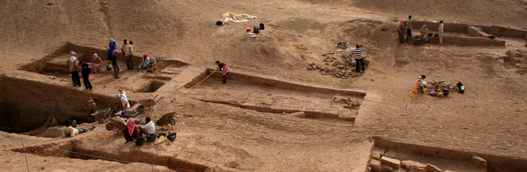
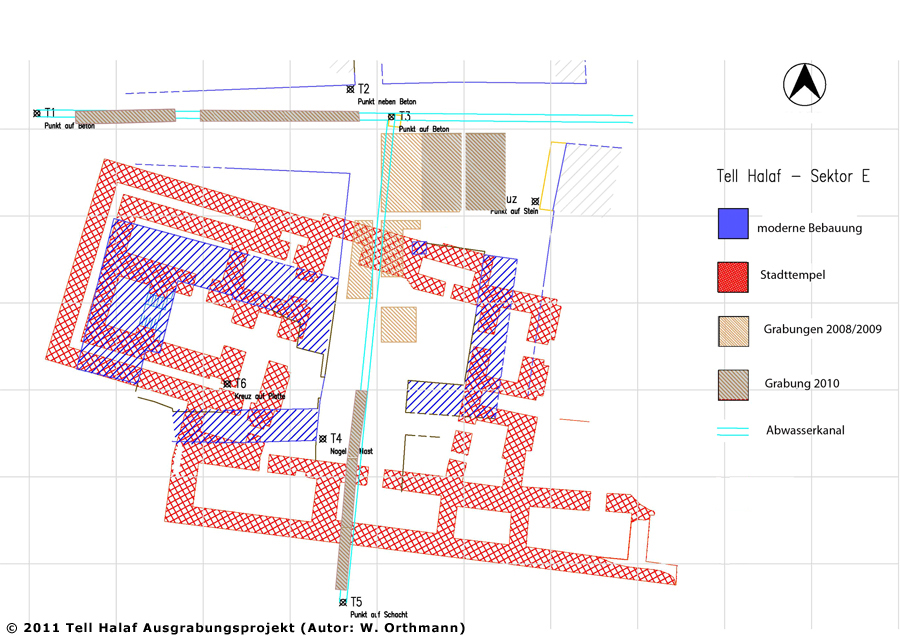
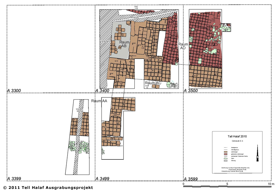
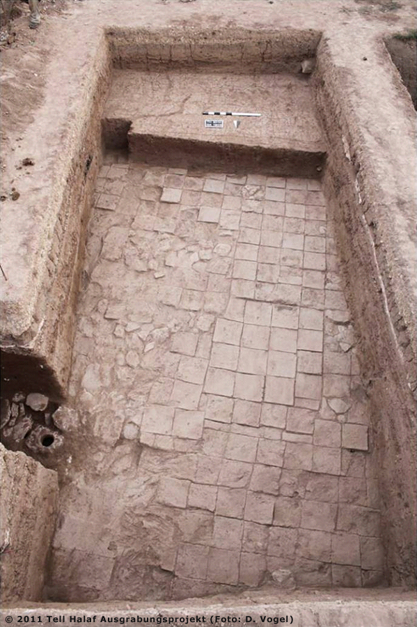
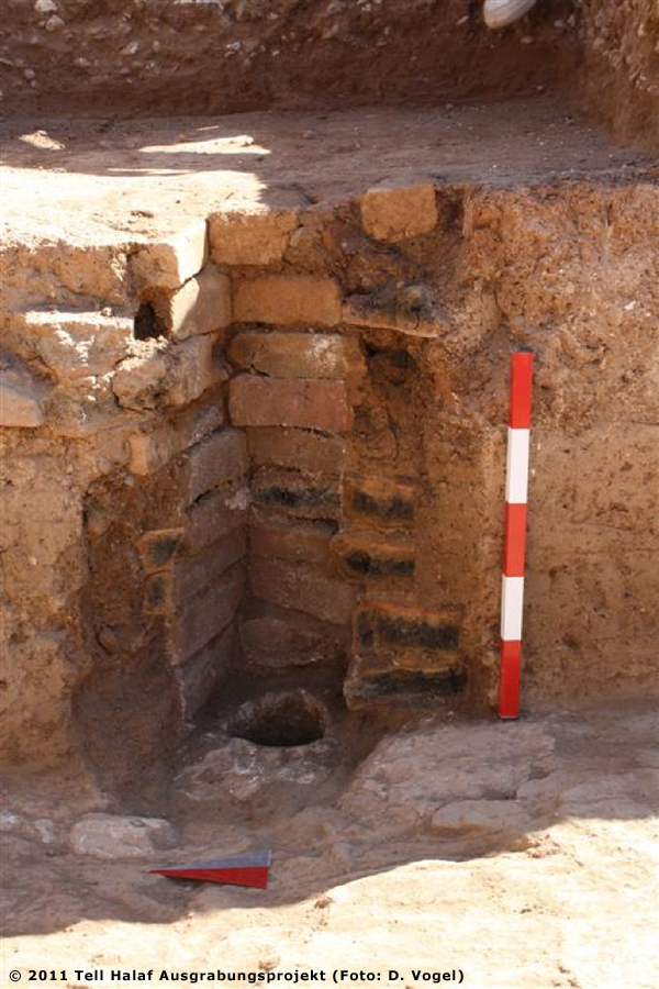
Area EProf. Dr. Winfried OrthmannExcavations at the «Stadttempel» 2010 In the entire excavated area, a very recent cover of fine gravel was encountered as the topmost layer. It was applied as a street surface after the sewer and water lines had been built. Beneath it follows a differently strong humos level with lots of modern trash. Consequently, it is probably to be seen as a surface layer produced by the modern settlement. Beneath the level of this building stratum 1, massive mudbrick settings were encountered in squares 3400 and 3500, as well as in the northern part of square 3499. Especially the different direction of the joints and the plaster that was recognized on the walls made it possible to distinguish the mudbricks belonging to the walls of this level from the filling levels. By removing the filling layers, floors were reached in the rooms bound by the walls in squares 3400 and 3500 (building level 02). The lowest recorded level in squares 3499, 3400 and 3500 consists of a massive terrace, the northern and eastern limits of which have not been found yet. In level 2, a building (E 4) stood upon this terrace. Its structure is well recognizable in the excavated areas. Courtyard AD covers the northeastern part of the excavated area. It is paved with burnt bricks and in some places with stones (Fig. 2-3). To the south, this courtyard ends at a wide wall with a doorway to room AC south of it at the eastern edge of square 3400. It is apparent that a wide doorway leading westwards to room AB, had originally existed. Later, it was narrowed and eventually is was completely closed. In courtyard AD an opening for a sewer channel was discovered at the eastern edge of square 3500 (Fig. 4). We were able to follow its covering stones a bit further eastwards in a small sounding. In the other rooms, we found no installations, which could have offered clues regarding their function. Any inventory they may have originally held, was obviously removed before the rooms were filled up with mudbricks. It is difficult to establish the relation between the structures in squares 3399, 3499, 3400 and 3500 to the «Stadttempel», excavated in 1913, as no clearly identifiable remains of the «Stadttempel» have been encountered in the excavations so far. If one assumes that the building was drawn at the correct location in the city-map of the old excavations, then the trenches in squares 3399, 3499, 3498, 3397 and 3396 should have revealed part of the temple-courtyard and the structures on its southern boundary (room N). We found no traces of the stone-slab pavement, that must have covered most of the courtyards area, according to the pictures from the earlier excavations. No convincing solution to this problem can be offered so far. It seems unlikely that the position of the «Stadttempel», which rested upon a small elevation inside the lower town, was measured completely wrong and that the buildings uncovered in squares 3400/3500 actually represent an older predecessor of the «Stadttempel» at the same position, given the otherwise very diligent building measurements executed by the architects of Max von Oppenheim’s excavations. If one considers the interpretation of the «Stadttempel» as a sanctuary of Nabû and Tašmetum, considered by E. Heinrich, the structures in squares 3400/3500 north of the actual temple may be seen as the side-rooms that are known from other Nabû-temples, which have been interpreted as akitu-festival houses by N. Postgate. However, because of the modern buildings above it, it will not be possible to excavate this building to an extent sufficient to secure such an interpretation. (Translation: A. Sollee / B. Sollee) |
|
||||||||
|
|
|||||||||